
FreeNavCharts.com, hype alert!
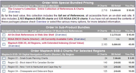
Oy, while I’m sleeping, a comments war breaks out over cheap charts (here and here). The main issue seems to be whether or not Maptech and NOAA’s free download sites are offering the same sets of raster charts, and therefore whether or not the various repackaging operations are offering the same chart DVDs. I don’t yet know the truth, but I am very dubious that Maptech is serving up a 1,000 more charts than NOAA is. Especially since the main source of this info seems to be a dubious site called FreeNavCharts.com. FreeNavCharts is offering a good service, and has lots of correct info about electronic charts, but, man, is it hyped up! Does a simple region of raster charts really have a retail value of $249.95, as suggested above? Hell no! Even when Maptech did sell $250 Digital ChartKit regions—before NOAA changed its chart policies—the package included much, much more than just the raster charts. And I’m afraid it gets worse at FreeNavCharts:
“It’s interesting to note that Maptech still sells the BSB-3 charts in a collection called Chart Navigator Pro for $499.95. The ‘Chart Navigator Pro’ collection includes 13 DVDs. While this sounds like a lot larger collection, they fail to tell you that all of the BSB charts on the 13 DVDs could easily fit on a single DVD! They are packaged with 13 individual DVDs to liquidate leftover inventory of Regional Collections.”
I have one of the very first copies of Chart Navigator Pro (CNP) and can tell you that the charts are updated into November 2005. In other words, the “liquidate leftover inventory” line is pure bullshit. Moreover, I just opened a random CNP DVD—St. Augustine to Crystal River, Florida—and here’s what’s on it besides for the RNCs and ENCs: 1.2 GB of 3D bathymetric data, 688 MB of topo maps, 1.7 GB of photo maps, 70 MB of panoramic photos, plus tide tables, pilot books, and lots of POI’s. Of course CNP also comes with a copy of Coastal Explorer software, which makes accessing all this data very easy (and also makes FreeNavCharts’s much hyped index meaningless).
Bottom line: FreeNavCharts—like ChartsDVD.com, and I’m sure there will be lots more—is just packaging and selling stuff that anyone can download. The true retail value of the disks is quite low. Yes, repackaging is a perfectly honorable service because the downloading is a pain, but confusing consumers with hype—and especially with lies about another company’s products—is dishonorable. Here’s hoping the FreeNavCharts.com cleans up its act.
PS 1/7: As suspected, the 1,016 RNCs listed by NOAA are the same as the 2,077 RNCs listed by Maptech; it’s just a matter of whether you list, say, a 4 page small craft chart as 1 or 4 charts. My source here is Jack Webb, proprietor of FreeNavCharts, who plans to change his site to reflect this reality. Thanks, Jack!


Got a copy of the Charts DVD (chartsdvd.com) to use with my CapN program. It does in fact contain all the NOAA RNC (BSB charts), but they are not organized by the more familar Maptech regions instead by chart number groups..
Group_1: Chart Numbers: 11006 – 11420
Group_2: Chart Numbers: 11424 – 12206
Group_3: Chart Numbers: 12207 – 12378
Group_4: Chart Numbers: 12401 – 14786
Group_5: Chart Numbers: 14788 – 14969
Group_6: Chart Numbers: 14970 – 16475
Group_7: Chart Numbers: 16476 – 17320
Group_8: Chart Numbers: 17321 – 18471
Group_9: Chart Numbers: 18473 – 18754
Group_10: Chart Numbers: 18755 – 26194 (and 50 – 5161)
Group_11: Chart Numbers: 81004 – 83637
The charts are in zip files adding yet another step to getting at the charts I need. The whole point of the DVD was to avoid having to download and extract the charts.
While the $29.95 price is a good deal, the extra savings will be eaten up by having to hunt down and unzip the charts I need.
I discovered something interesting today about several of the NOAA RNC’s. Several are lacking calibration information making them unusable..
(I did not have this problem with the same Maptech ones).
BSB_ROOT\11324\11324_2.KAP
BSB_ROOT\11326\11326_7.KAP
BSB_ROOT\11451\11451_16.KAP
BSB_ROOT\11451\11451_17.KAP
BSB_ROOT\11541\11541_6.KAP
BSB_ROOT\12205\12205_13.KAP
BSB_ROOT\12285\12285_18.KAP
BSB_ROOT\12285\12285_19.KAP
BSB_ROOT\12352\12352_8.KAP
BSB_ROOT\12364\12364_24.KAP
BSB_ROOT\12372\12372_19.KAP
BSB_ROOT\13221\13221_2.KAP
BSB_ROOT\13229\13229_15.KAP
BSB_ROOT\14786\14786_79.KAP
BSB_ROOT\14786\14786_80.KAP
BSB_ROOT\14786\14786_81.KAP
BSB_ROOT\14786\14786_82.KAP
BSB_ROOT\14786\14786_83.KAP
BSB_ROOT\14786\14786_84.KAP
BSB_ROOT\14786\14786_85.KAP
BSB_ROOT\14786\14786_86.KAP
BSB_ROOT\14786\14786_87.KAP
BSB_ROOT\14786\14786_88.KAP
BSB_ROOT\14842\14842_45.KAP
BSB_ROOT\14842\14842_46.KAP
BSB_ROOT\14842\14842_47.KAP
BSB_ROOT\14842\14842_48.KAP
BSB_ROOT\14842\14842_49.KAP
BSB_ROOT\14842\14842_50.KAP
BSB_ROOT\14842\14842_51.KAP
BSB_ROOT\14846\14846_39.KAP
BSB_ROOT\14846\14846_40.KAP
BSB_ROOT\14846\14846_41.KAP
BSB_ROOT\14846\14846_42.KAP
BSB_ROOT\14846\14846_43.KAP
BSB_ROOT\14846\14846_44.KAP
BSB_ROOT\14853\14853_48.KAP
BSB_ROOT\14853\14853_49.KAP
BSB_ROOT\14853\14853_50.KAP
BSB_ROOT\14853\14853_51.KAP
BSB_ROOT\14853\14853_52.KAP
BSB_ROOT\14853\14853_53.KAP
BSB_ROOT\14853\14853_54.KAP
BSB_ROOT\14886\14886_15.KAP
BSB_ROOT\14886\14886_16.KAP
BSB_ROOT\14886\14886_17.KAP
BSB_ROOT\14886\14886_18.KAP
BSB_ROOT\14886\14886_19.KAP
BSB_ROOT\14916\14916_37.KAP
BSB_ROOT\14916\14916_38.KAP
BSB_ROOT\14916\14916_39.KAP
BSB_ROOT\14916\14916_40.KAP
BSB_ROOT\14916\14916_41.KAP
BSB_ROOT\14916\14916_42.KAP
BSB_ROOT\14916\14916_43.KAP
BSB_ROOT\14926\14926_33.KAP
BSB_ROOT\14926\14926_34.KAP
BSB_ROOT\14926\14926_35.KAP
BSB_ROOT\14926\14926_36.KAP
BSB_ROOT\14926\14926_37.KAP
BSB_ROOT\18423\18423_19.KAP
BSB_ROOT\18445\18445_17.KAP
Has anyone else experienced trouble using any of the above NOAA RNCs?
Maptech has provided clarification on the above charts. They are not charts, but informational graphics that do not have calibration information. I will add support for these to GPSNavX and MacENC.
Downloads directly from NOAA are easy, especially if you know the chart numbers. They have a check-box type text download page: BSB Raster Chart downloads. I found their graphical interface a bit wanting – the above is easier. I checked off charts from Vancouver through Oregon and it was a 140MB download, not all that long with DSL. Files come zipped so are easy to use with either Mac or PC.
Really why spend money on the entire US waterway DVD? How far can you cruise??
I couldn’t get “Free Nautical Charts” to work at all and it was a very complex sign-on system/email confirmation/error message/approval loop. Forget it and go directly to NOAA.
Also not widely reported is that NOAA also has .pdf version of the Coast Pilot available. What’s nice is that these are separated into chapters and usually one or two chapters is all you need.
Poking around in the Office of Coast Survey is fun, they have lots of historic charts and a lot more free!
Jack